Recent updates / 最新动态
地理信息技术助力飞行程序设计和航空情报管理
Empower flight procedures and aeronautical information with geoinformatics.
Teach & Research / 教学与研究
Work at a teaching- and application-oriented institution / 在教学应用型院校
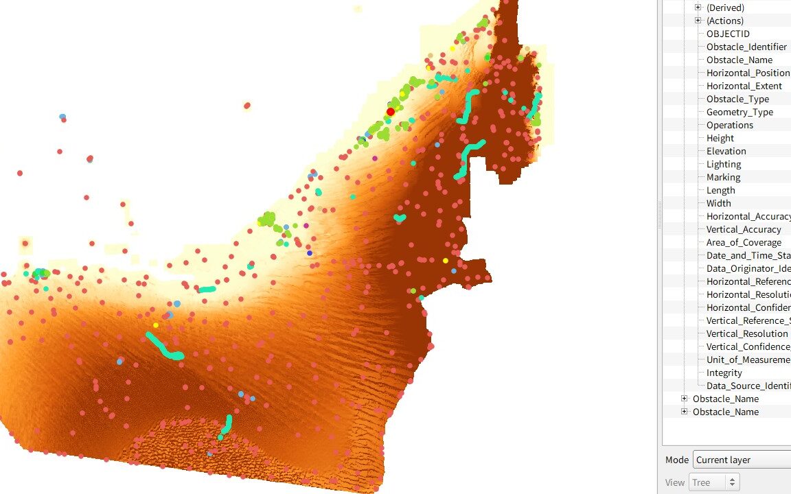
Aeronautical information service/management
航空情报服务与管理 (AIS/AIM)
Compile and distribute charts, Notice to Airmen/Air Missions (NOTAM), and datasets
航图、航行通告及数据集的编发
Flight procedure design 飞行程序设计
Design flight paths, compose protection areas, assess obstacles near or at airports
机场周边飞行路径设计、保护区绘制、障碍物评估
Geoinformatics & Charting 地理信息与航图
Store, process, represent the spatial (and temporal) dimension of aviation operations
数字化存储、处理、表达飞机运行的时空间维度
Educational research 教学研究
Course/curriculum design and educational tecnologies that promote learning outcome
提升学习产出的课程设计与教育技术
Undergrad intern & mentoring 本科生指导
Research/software dev internship/projects, student contests, and undergrad theses
研究/开发实习与项目、学生竞赛、毕业论文
Projects / 项目
previous and ongoing / 已有和在研
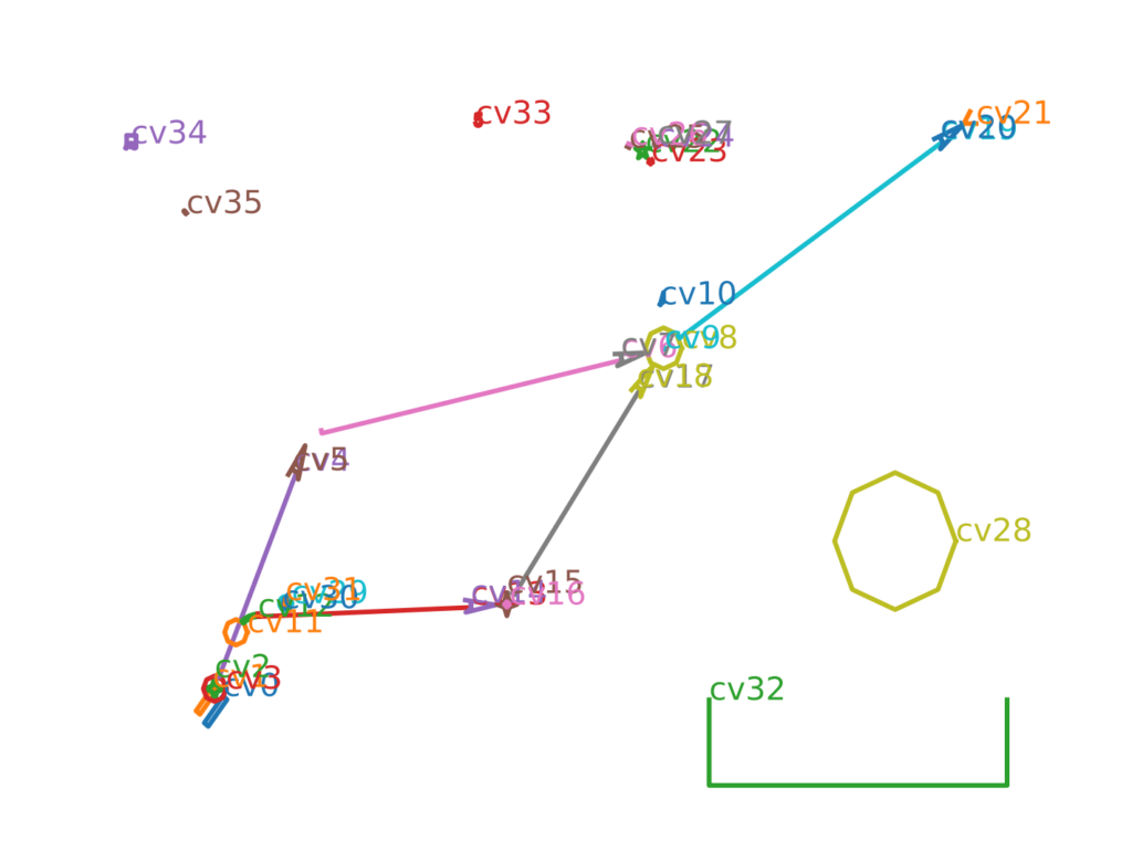
飞行程序数据集自动提取与生成
- 解析PDF格式的AIP航图
- 识别几何图元表示的实体符号
- 重建飞行程序链条
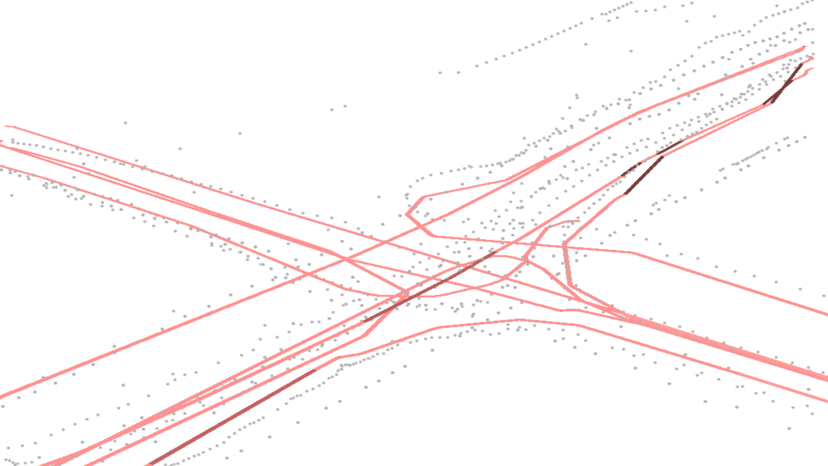
轨迹数据驱动的道路复杂结构提取
- 2016-2021, 武汉; 学位论文
- 交叉口三维几何结构与高程语义提取
- 路段通行与路口转向异常限制事件提取
Leave a message 留言交流
… if you are interested